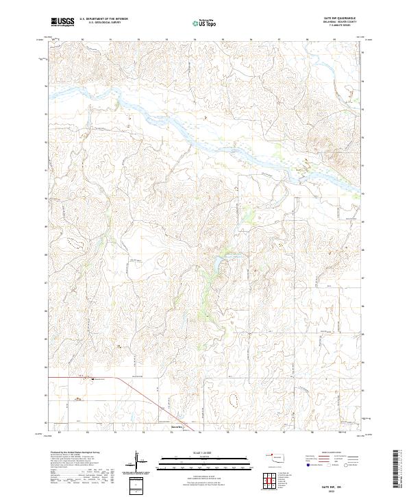
2022 Map of Gate NW
USGS Topo · Published 2022About this map
Knowles and its surrounding High Plains ranching landscape are captured in this 2022 survey of Beaver County. The settlement lies along the southern edge of the map, anchored by the Knowles Cem and a grid of rural section roads. The landscape is defined by the broad, braided path of the Cimarron River as it cuts across the northern half of the quadrangle. This arid drainage system is fed by numerous seasonal tributaries, including Taintor Creek, Cottonwood Creek, and Crooked Creek, which have carved intricate breaks into the terrain. A notable modern water feature, the Barby-Sargent Number 3 Reservoir, stands out in the central section, illustrating contemporary water management in this semi-arid region of the Oklahoma Panhandle.
Find a feature on this map
51 named features on this map. Tap any name to fly to it.
Don’t see what you’re looking for? This feature index may not catch every label — zoom into the map to look around manually.
Map Details
Editions of this 2022 Gate NW Map
This is the sole edition of this map. No revisions or reprints were ever made.
Other maps of this area

1892 · Meade
USGS Topo · 1:125,000

1954 · Perryton
USGS Topo · 1:250,000

1955 · Dodge City
USGS Topo · 1:250,000

1958 · Perryton
USGS Topo · 1:250,000

1958 · Dodge City
USGS Topo · 1:250,000

1959 · Dodge City
USGS Topo · 1:250,000

1962 · Irish Flats SE
USGS Topo · 1:24,000

1970 · Knowles
USGS Topo · 1:24,000

1970 · Gate
USGS Topo · 1:24,000
1970 · Gate NE
USGS Topo · 1:24,000