
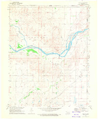
1970 Map of Gate NW
USGS Topo · Published 1973About this map
The Cimarron River winds across this panhandle landscape, cutting through the terrain just south of the border between Kansas and Oklahoma. This 1970 snapshot shows a region defined by its energy and transport infrastructure, where numerous gas wells are scattered across the plains. In the southern portion of the sheet, the settlement of Knowles sits along the Missouri-Kansas-Texas railroad line. Local history is anchored by the Knowles Cem and a prominent Radio Tower nearby. Water sources like Crooked Creek, Cottonwood Creek, and Painter Creek create natural drainage patterns toward the Cimarron, while the presence of a Gravel Pit indicates local industrial activity. The map also records the boundary between Meade and Beaver Counties, marking the intersection of state and local jurisdictions in this quiet corner of the plains.
Find a feature on this map
14 named features on this map. Tap any name to fly to it.
Don’t see what you’re looking for? This feature index may not catch every label — zoom into the map to look around manually.
Map Details
Editions of this 1970 Gate NW Map
This is the sole edition of this map. No revisions or reprints were ever made.
Other maps of this area

1892 · Meade
USGS Topo · 1:125,000

1954 · Perryton
USGS Topo · 1:250,000

1955 · Dodge City
USGS Topo · 1:250,000

1958 · Perryton
USGS Topo · 1:250,000

1958 · Dodge City
USGS Topo · 1:250,000

1959 · Dodge City
USGS Topo · 1:250,000

1962 · Irish Flats SE
USGS Topo · 1:24,000

1970 · Knowles
USGS Topo · 1:24,000

1970 · Gate
USGS Topo · 1:24,000
1970 · Gate NE
USGS Topo · 1:24,000