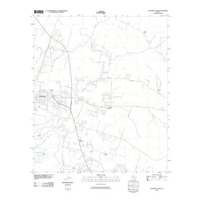
2010 Map of Gatesville East
USGS Topo · Published 2010About this map
The Leon River carves a winding path through this central Texas landscape, anchoring the development of the regional hub at Gatesville. The city's eastern expansion is clearly marked by the adjacent communities of South Mountain and Fort Gates, showing a shift from high-density urban blocks to more dispersed residential and agricultural patterns. This 2010 survey is particularly useful for genealogical research, documenting numerous burial grounds including Restland Cemetery, Odd Fellows Cemetery, and the Fort Gates Cemetery. The map also captures several man-made water features south of the city, such as Peni-Bilt Lake and the Kercho Lake Dam. Named roads like Old Waco Rd and Straw Mills Rd reflect the older transportation corridors that once connected these rural settlements before the modernization of the local highway system.
Find a feature on this map
55 named features on this map. Tap any name to fly to it.
Don’t see what you’re looking for? This feature index may not catch every label — zoom into the map to look around manually.
Map Details
Editions of this 2010 Gatesville East Map
This is the sole edition of this map. No revisions or reprints were ever made.
Other maps of this area

1888 · Meridian
USGS Topo · 1:125,000

1894 · Meridian
USGS Topo · 1:125,000

1894 · Gatesville
USGS Topo · 1:125,000

1947 · Purmela
USGS Topo · 1:62,500

1947 · Oglesby
USGS Topo · 1:24,000

1947 · Gatesville West
USGS Topo · 1:24,000
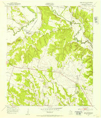
1947 · Leon Junction
USGS Topo · 1:24,000

1947 · North Fort Hood
USGS Topo · 1:24,000

1947 · Gatesville East
USGS Topo · 1:24,000

1947 · Shell Mountains
USGS Topo · 1:24,000