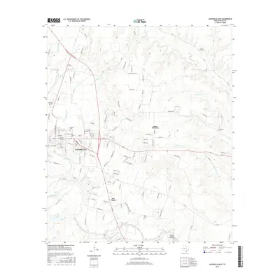
2016 Map of Gatesville East
USGS Topo · Published 2016About this map
Gatesville serves as the central hub of this Central Texas landscape, where the Leon River winds past the town’s southern edge. The map reveals a dense network of local history through its numerous cemeteries, including Restland Cem, Odd Fellows Cem, and Oak Grove Cem, providing valuable touchpoints for genealogical research. To the southeast, the community of Fort Gates sits near the river, accompanied by its own namesake Fort Gates Cem and the Powell Cem.
Find a feature on this map
121 named features on this map. Tap any name to fly to it.
Don’t see what you’re looking for? This feature index may not catch every label — zoom into the map to look around manually.
Map Details
Editions of this 2016 Gatesville East Map
This is the sole edition of this map. No revisions or reprints were ever made.
Other maps of this area

1888 · Meridian
USGS Topo · 1:125,000

1894 · Meridian
USGS Topo · 1:125,000

1894 · Gatesville
USGS Topo · 1:125,000

1947 · Purmela
USGS Topo · 1:62,500

1947 · Oglesby
USGS Topo · 1:24,000

1947 · Gatesville West
USGS Topo · 1:24,000
1947 · Leon Junction
USGS Topo · 1:24,000

1947 · North Fort Hood
USGS Topo · 1:24,000

1947 · Gatesville East
USGS Topo · 1:24,000

1947 · Shell Mountains
USGS Topo · 1:24,000