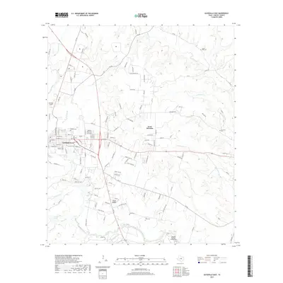
2019 Map of Gatesville East
USGS Topo · Published 2019About this map
Gatesville sits at the western edge of this Coryell County landscape, where the Leon River winds through the terrain. The 2019 survey documents a high concentration of established burial sites, including the Odd Fellows Cem, Oak Grove Cem, and Restland Cem, which serve as vital touchstones for genealogical research in the area. The map illustrates a transition from the urban grid of the county seat into the undulating hills of South Mountain, defined by a network of farm-to-market roads and creeks like Turnover Cr and N Greenbriar Cr. Beyond the residential developments, the landscape includes specialized infrastructure such as the Longhorn Auxiliary Landing Strip and the McGregor Airport, reflecting the region's aviation and military connections. Scattered family-named cemeteries like Powell Cem and Brown Cem remain preserved across the rural sectors, marking the sites of early homesteads and communities.
Find a feature on this map
129 named features on this map. Tap any name to fly to it.
Don’t see what you’re looking for? This feature index may not catch every label — zoom into the map to look around manually.
Map Details
Editions of this 2019 Gatesville East Map
This is the sole edition of this map. No revisions or reprints were ever made.
Other maps of this area

1888 · Meridian
USGS Topo · 1:125,000

1894 · Meridian
USGS Topo · 1:125,000

1894 · Gatesville
USGS Topo · 1:125,000

1947 · Purmela
USGS Topo · 1:62,500

1947 · Oglesby
USGS Topo · 1:24,000

1947 · Gatesville West
USGS Topo · 1:24,000
1947 · Leon Junction
USGS Topo · 1:24,000

1947 · North Fort Hood
USGS Topo · 1:24,000

1947 · Gatesville East
USGS Topo · 1:24,000

1947 · Shell Mountains
USGS Topo · 1:24,000