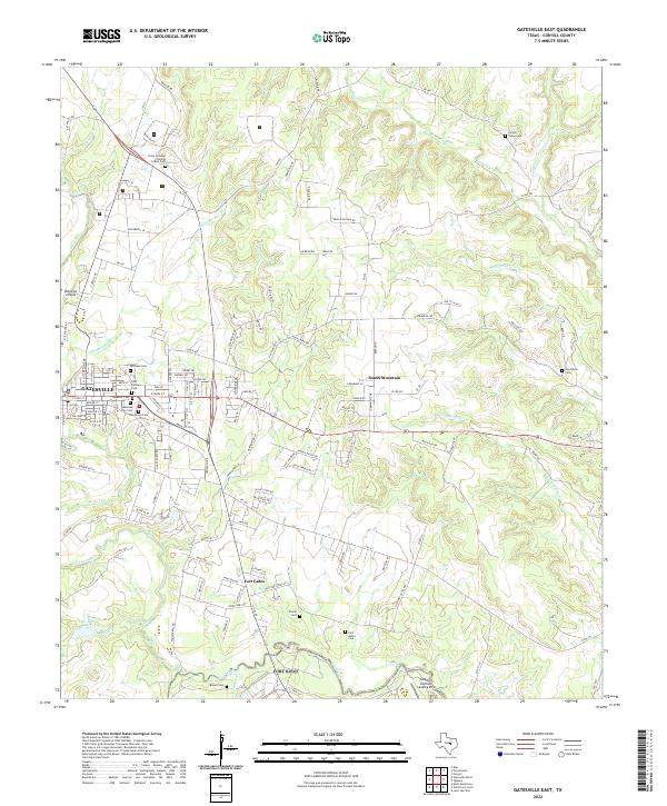
2022 Map of Gatesville East
USGS Topo · Published 2022About this map
The Leon River meanders through this portion of Coryell County, defining a landscape where rural development meets the eastern edge of Gatesville. The city's concentration of historical burial grounds, including the Masonic Cem, Odd Fellows Cem, and Oak Grove Cem, suggests a long-standing community core with distinct fraternal and civic identities. Just north of the main settlement lies the State Juvenile Training School Cem, a poignant reminder of the area's institutional history.
Find a feature on this map
129 named features on this map. Tap any name to fly to it.
Don’t see what you’re looking for? This feature index may not catch every label — zoom into the map to look around manually.
Map Details
Editions of this 2022 Gatesville East Map
This is the sole edition of this map. No revisions or reprints were ever made.
Other maps of this area

1888 · Meridian
USGS Topo · 1:125,000

1894 · Meridian
USGS Topo · 1:125,000

1894 · Gatesville
USGS Topo · 1:125,000

1947 · Purmela
USGS Topo · 1:62,500

1947 · Oglesby
USGS Topo · 1:24,000

1947 · Gatesville West
USGS Topo · 1:24,000
1947 · Leon Junction
USGS Topo · 1:24,000

1947 · North Fort Hood
USGS Topo · 1:24,000

1947 · Gatesville East
USGS Topo · 1:24,000

1947 · Shell Mountains
USGS Topo · 1:24,000