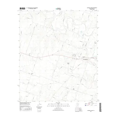
2016 Map of Gatesville West
USGS Topo · Published 2016About this map
Gatesville serves as the focal point for this Central Texas landscape, where the meandering Leon River defines much of the eastern terrain. The area is characterized by a mix of agricultural land and rising elevations, most notably at Bald Knob to the south. Transportation and utility are central to the region, evidenced by the presence of both the Gatesville Municipal Airport and McGregor Airport, alongside a dense network of county roads like Moccasin Bend Rd and Faubion Rd. Local history is anchored by the Hemelline Cem and established family-named landmarks. The drainage system is intricate, with numerous waterways such as Plum Cr, Blue Br, and Dodd Br feeding into the larger river basin, while Walker Lake and Anchor Lake provide significant local water features.
Find a feature on this map
70 named features on this map. Tap any name to fly to it.
Don’t see what you’re looking for? This feature index may not catch every label — zoom into the map to look around manually.
Map Details
Editions of this 2016 Gatesville West Map
This is the sole edition of this map. No revisions or reprints were ever made.
Other maps of this area

1888 · Meridian
USGS Topo · 1:125,000

1894 · Meridian
USGS Topo · 1:125,000

1894 · Gatesville
USGS Topo · 1:125,000

1947 · Purmela
USGS Topo · 1:62,500

1947 · Gatesville West
USGS Topo · 1:24,000

1947 · Pidcoke
USGS Topo · 1:24,000

1947 · North Fort Hood
USGS Topo · 1:24,000

1947 · Purmela
USGS Topo · 1:24,000

1947 · Gatesville East
USGS Topo · 1:24,000

1947 · Shell Mountains
USGS Topo · 1:24,000