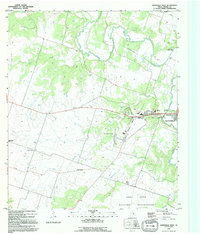
1995 Map of Gatesville West
USGS Topo · Published 1995About this map
The western edges of Gatesville and the expansive Fort Hood Military Reservation anchor this mid-1990s landscape in Coryell County. The terrain is defined by the winding course of the Leon River and its various tributaries, including Plum Creek, Dodd Branch, and Cottonwood Creek. Cultural landmarks such as Bethel Heights Church, Standifer Chapel, and Hermeline Cem provide valuable reference points for genealogists tracking family ties in the rural areas west of the city center.
Find a feature on this map
24 named features on this map. Tap any name to fly to it.
Don’t see what you’re looking for? This feature index may not catch every label — zoom into the map to look around manually.
Map Details
Editions of this 1995 Gatesville West Map
This is the sole edition of this map. No revisions or reprints were ever made.
Other maps of this area

1888 · Meridian
USGS Topo · 1:125,000

1894 · Meridian
USGS Topo · 1:125,000

1894 · Gatesville
USGS Topo · 1:125,000

1947 · Purmela
USGS Topo · 1:62,500

1947 · Gatesville West
USGS Topo · 1:24,000

1947 · Pidcoke
USGS Topo · 1:24,000

1947 · North Fort Hood
USGS Topo · 1:24,000

1947 · Purmela
USGS Topo · 1:24,000

1947 · Gatesville East
USGS Topo · 1:24,000

1947 · Shell Mountains
USGS Topo · 1:24,000