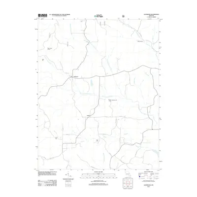
2012 Map of Gatewood
USGS Topo · Published 2012About this map
Gatewood and Tucker anchor this rural landscape in the Missouri Ozarks, where the drainage network of the Fourche Creek system dictates the settlement pattern. Small communities and landmarks are interspersed among a series of named ridges and valleys, such as Bald Hill, Reed Hill, and the historically evocative Rebel Hollow. The map provides a detailed look at the infrastructure of the early 21st century, including the Mulvinia Lookout Tower atop Mulvinia Hill, a point of significant local elevation.
Find a feature on this map
29 named features on this map. Tap any name to fly to it.
Don’t see what you’re looking for? This feature index may not catch every label — zoom into the map to look around manually.
Map Details
Editions of this 2012 Gatewood Map
This is the sole edition of this map. No revisions or reprints were ever made.
Other maps of this area

1935 · Reyno
USGS Topo · 1:62,500

1939 · Doniphan
USGS Topo · 1:62,500

1941 · Gatewood
USGS Topo · 1:62,500

1945 · Doniphan
USGS Topo · 1:62,500

1945 · Gatewood
USGS Topo · 1:62,500

1957 · Poplar Bluff
USGS Topo · 1:250,000

1959 · Poplar Bluff
USGS Topo · 1:250,000

1960 · Poplar Bluff
USGS Topo · 1:250,000
1965 · Riverton
USGS Topo · 1:24,000

1965 · Gatewood
USGS Topo · 1:24,000