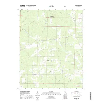
2017 Map of Gatewood
USGS Topo · Published 2017About this map
Gatewood and Tucker serve as the primary focal points of this southern Missouri landscape, situated within the eastern reaches of the Mark Twain National Forest. The topography is defined by a dense network of ridges and drainages, where numerous hollows such as Steam Mill Hollow and Brown Spring Hollow feed into the prominent waterways of the Middle Fork Fourche Cr and W Fork Fourche Cr. The terrain is punctuated by significant rises like Bald Hill, Mulvinia Hill, and Reed Hill, reflecting the characteristic Ozark landform of the region. This 2017 survey details a landscape where rural life is intimately tied to the forest boundaries and the winding creek beds that dictate the path of local corridors like State Hwy Z and State Hwy P.
Find a feature on this map
48 named features on this map. Tap any name to fly to it.
Don’t see what you’re looking for? This feature index may not catch every label — zoom into the map to look around manually.
Map Details
Editions of this 2017 Gatewood Map
This is the sole edition of this map. No revisions or reprints were ever made.
Other maps of this area

1935 · Reyno
USGS Topo · 1:62,500

1939 · Doniphan
USGS Topo · 1:62,500

1941 · Gatewood
USGS Topo · 1:62,500

1945 · Doniphan
USGS Topo · 1:62,500

1945 · Gatewood
USGS Topo · 1:62,500

1957 · Poplar Bluff
USGS Topo · 1:250,000

1959 · Poplar Bluff
USGS Topo · 1:250,000

1960 · Poplar Bluff
USGS Topo · 1:250,000
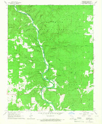
1965 · Riverton
USGS Topo · 1:24,000

1965 · Gatewood
USGS Topo · 1:24,000