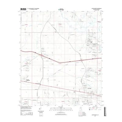
2015 Map of Gautier North
USGS Topo · Published 2015About this map
Ocean Springs and Gautier anchor this coastal Mississippi landscape, where the intricate hydrology of the Gulf Coast is on full display. The northern half of the map is dominated by the meandering reaches of Old Fort Bayou and Bluff Creek, which feed into the W Pascagoula River along the eastern edge. Local history is preserved in small settlements and family landmarks such as Colle Field and Hilda, as well as the Taylor Cem located near the headwaters of Sioux Bayou. Residential development radiates from the core of Gautier through neighborhoods like Hickory Hills and Martin Bluff, while the corridor of the Old Spanish Trl provides a historical link across the southern portion of the quadrangle. The map captures the balance between dense suburban planning and the expansive wetlands of Mary Walker Bayou.
Find a feature on this map
166 named features on this map. Tap any name to fly to it.
Don’t see what you’re looking for? This feature index may not catch every label — zoom into the map to look around manually.
Map Details
Editions of this 2015 Gautier North Map
This is the sole edition of this map. No revisions or reprints were ever made.
Other maps of this area

1941 · Vancleave
USGS Topo · 1:62,500

1943 · Pascagoula
USGS Topo · 1:62,500

1943 · Vancleave
USGS Topo · 1:62,500

1944 · Vancleave
USGS Topo · 1:62,500

1953 · Mobile
USGS Topo · 1:250,000

1954 · Vestry
USGS Topo · 1:62,500

1954 · Ocean Springs
USGS Topo · 1:24,000

1954 · Deer Island
USGS Topo · 1:24,000

1954 · Biloxi
USGS Topo · 1:62,500

1955 · Pascagoula
USGS Topo · 1:62,500