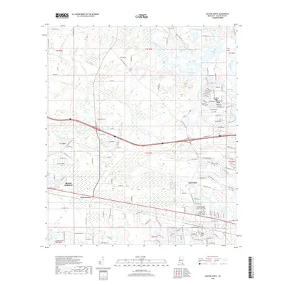
2018 Map of Gautier North
USGS Topo · Published 2018About this map
Bluff Creek and the meandering Old Fort Bayou dominate this coastal Mississippi landscape, where suburban expansion meets the intricate wetlands of Jackson County. In the eastern portion of the map, the city of Gautier is characterized by its significant educational institutions, including the Mississippi Gulf Coast Community College - Jackson County Campus and a satellite teaching site for the University of Southern Mississippi. The residential layout reflects modern growth, with neighborhoods like Hickory Hills and Martin Bluff established along the intricate waterway systems of Sioux Bayou and Mary Walker Bayou. To the west, the outskirts of Ocean Springs and the settlement of Fontainebleau mark the transition toward the bayou country. The map captures a high degree of modern infrastructure, from College Park Elem School to the preserved Taylor Cem, illustrating the 21st-century character of the Gulf Coast.
Find a feature on this map
135 named features on this map. Tap any name to fly to it.
Don’t see what you’re looking for? This feature index may not catch every label — zoom into the map to look around manually.
Map Details
Editions of this 2018 Gautier North Map
This is the sole edition of this map. No revisions or reprints were ever made.
Other maps of this area

1941 · Vancleave
USGS Topo · 1:62,500

1943 · Pascagoula
USGS Topo · 1:62,500

1943 · Vancleave
USGS Topo · 1:62,500

1944 · Vancleave
USGS Topo · 1:62,500

1953 · Mobile
USGS Topo · 1:250,000

1954 · Vestry
USGS Topo · 1:62,500

1954 · Ocean Springs
USGS Topo · 1:24,000

1954 · Deer Island
USGS Topo · 1:24,000

1954 · Biloxi
USGS Topo · 1:62,500

1955 · Pascagoula
USGS Topo · 1:62,500