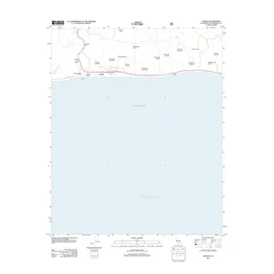
2012 Map of Gaviota
USGS Topo · Published 2012About this map
The Gaviota Pass cuts through the coastal mountains of Santa Barbara County, providing a critical transit corridor between the interior and the Pacific Ocean. This coastal landscape is defined by a series of north-south canyons, or cañadas, that drain into the sea, including Cañada del Cementerio, Cañada San Onofre, and Arroyo Hondo. Along the immediate shoreline, human activity centers on the Gaviota Pier and the adjacent Gaviota Beach, where transportation infrastructure like the historic Calle Real and Hollister Ranch Rd navigate the narrow shelf between the hills and the surf. Small named locations such as Port Orford and Lento mark specific points of interest along the rail and road network, while the towering Gaviota Peak overlooks the entire maritime and terrestrial interface.
Find a feature on this map
24 named features on this map. Tap any name to fly to it.
Don’t see what you’re looking for? This feature index may not catch every label — zoom into the map to look around manually.
Map Details
Editions of this 2012 Gaviota Map
This is the sole edition of this map. No revisions or reprints were ever made.
Other maps of this area

1905 · Lompoc
USGS Topo · 1:125,000

1942 · Lompoc
USGS Topo · 1:125,000

1942 · Lompoc
USGS Topo · 1:62,500

1942 · Pt. Conception
USGS Topo · 1:62,500

1942 · Gaviota
USGS Topo · 1:62,500

1942 · Los Olivos
USGS Topo · 1:62,500

1943 · Los Olivos
USGS Topo · 1:62,500

1943 · Lompoc
USGS Topo · 1:125,000

1943 · Gaviota
USGS Topo · 1:62,500

1947 · Gaviota
USGS Topo · 1:62,500