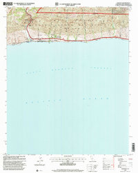
1995 Map of Gaviota
USGS Topo · Published 2000About this map
The Santa Ynez Mountains dominate the northern landscape of this coastal quadrangle, where the narrow passage of Gaviota Pass provides a vital corridor between the mountains and the sea. The 1990s infrastructure is clearly defined by the Gaviota Pass Tunnel and the route of 101, which skirts the coastline alongside the Southern Pacific railroad. Maritime history and industrial activity intersect at the shoreline, with the presence of an Oil Refinery, Oil Tanks, and the Seawall protecting the transportation corridor.
Find a feature on this map
31 named features on this map. Tap any name to fly to it.
Don’t see what you’re looking for? This feature index may not catch every label — zoom into the map to look around manually.
Map Details
Editions of this 1995 Gaviota Map
This is the sole edition of this map. No revisions or reprints were ever made.
Other maps of this area

1905 · Lompoc
USGS Topo · 1:125,000

1942 · Lompoc
USGS Topo · 1:125,000

1942 · Lompoc
USGS Topo · 1:62,500

1942 · Pt. Conception
USGS Topo · 1:62,500

1942 · Gaviota
USGS Topo · 1:62,500

1942 · Los Olivos
USGS Topo · 1:62,500

1943 · Los Olivos
USGS Topo · 1:62,500

1943 · Lompoc
USGS Topo · 1:125,000

1943 · Gaviota
USGS Topo · 1:62,500

1947 · Gaviota
USGS Topo · 1:62,500