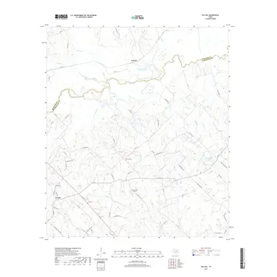
2019 Map of Gay Hill
USGS Topo · Published 2019About this map
Yegua Creek meanders along the boundary between Burleson and Washington Counties, defining a landscape of riparian lowlands and agricultural plateaus. The rural community of Gay Hill serves as a southern anchor, surrounded by legacy farm-to-market roads and cemeteries that provide vital data for local genealogists. Evidence of multi-generational land use is found at Oak Rest Cem, Wallace Cem, and Frieden Cem, scattered among family-named routes like Janner Kuecker Ln and Dannheim Rd.
Find a feature on this map
64 named features on this map. Tap any name to fly to it.
Don’t see what you’re looking for? This feature index may not catch every label — zoom into the map to look around manually.
Map Details
Editions of this 2019 Gay Hill Map
This is the sole edition of this map. No revisions or reprints were ever made.
Other maps of this area

1914 · Gay Hill
USGS Topo · 1:62,500

1930 · Brenham
USGS Topo · 1:62,500

1954 · Austin
USGS Topo · 1:250,000

1956 · Brenham
USGS Topo · 1:62,500

1956 · Somerville
USGS Topo · 1:62,500

1958 · Burton
USGS Topo · 1:24,000

1959 · Gay Hill
USGS Topo · 1:24,000

1959 · Clay
USGS Topo · 1:24,000

1959 · Somerville
USGS Topo · 1:24,000

1959 · Independence
USGS Topo · 1:24,000