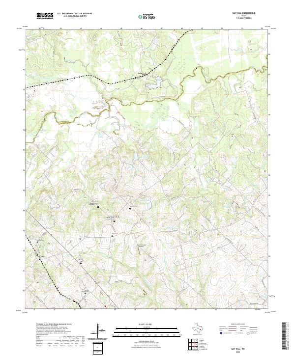
2022 Map of Gay Hill
USGS Topo · Published 2022About this map
Gay Hill and the surrounding Washington County landscape are defined by a complex network of creeks and legacy family cemeteries. The terrain is bisected by Yegua Creek, which forms the border with Burleson County to the north, while smaller waterways like Tommelson Cr and Chriesman Br drain the rolling countryside. This area is particularly significant for genealogical research, containing numerous burial sites such as Old Gay Hill Baptist Church Cem Number One, Old Gay Hill Baptist Church Cem Number Two, and Saint Peters Lutheran Cem.
Find a feature on this map
70 named features on this map. Tap any name to fly to it.
Don’t see what you’re looking for? This feature index may not catch every label — zoom into the map to look around manually.
Map Details
Editions of this 2022 Gay Hill Map
This is the sole edition of this map. No revisions or reprints were ever made.
Other maps of this area

1914 · Gay Hill
USGS Topo · 1:62,500

1930 · Brenham
USGS Topo · 1:62,500

1954 · Austin
USGS Topo · 1:250,000

1956 · Brenham
USGS Topo · 1:62,500

1956 · Somerville
USGS Topo · 1:62,500

1958 · Burton
USGS Topo · 1:24,000

1959 · Gay Hill
USGS Topo · 1:24,000

1959 · Clay
USGS Topo · 1:24,000

1959 · Somerville
USGS Topo · 1:24,000

1959 · Independence
USGS Topo · 1:24,000