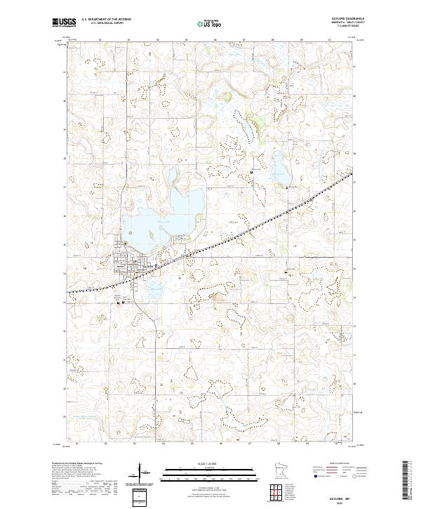
2022 Map of Gaylord
USGS Topo · Published 2022About this map
Gaylord serves as the focal point of this Sibley County landscape, situated amidst a dense network of glacial lakes and agricultural drainage systems. The town layout is clearly defined by the Sibley County Courthouse and a series of civic spaces near the shores of Titlow Lake. Local history is deeply rooted in the surrounding countryside, evidenced by numerous burial grounds including Gaylord Municipal Cem, Saint John's Cem, and Saint Pauls Cem. Beyond the city limits, the terrain is shaped by water management features like High Island Ditch Number Five and County Ditch Number Fortythree, which reflect the region's intensive agricultural character. The map captures the interface between small-town infrastructure and the prairie pothole landscape, with Beatty Lake and Mud Lake providing significant natural landmarks among the township roads and section lines.
Find a feature on this map
62 named features on this map. Tap any name to fly to it.
Don’t see what you’re looking for? This feature index may not catch every label — zoom into the map to look around manually.
Map Details
Editions of this 2022 Gaylord Map
This is the sole edition of this map. No revisions or reprints were ever made.
Other maps of this area

1953 · New Ulm
USGS Topo · 1:250,000

1957 · New Ulm
USGS Topo · 1:250,000

1958 · New Ulm
USGS Topo · 1:250,000

1958 · Gaylord
USGS Topo · 1:62,500

1958 · Winthrop
USGS Topo · 1:62,500

1964 · Bernadotte
USGS Topo · 1:24,000

1965 · Norseland
USGS Topo · 1:24,000

1965 · New Sweden
USGS Topo · 1:24,000

1967 · New Ulm
USGS Topo · 1:250,000
1982 · Gaylord
USGS Topo · 1:24,000