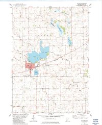
1982 Map of Gaylord
USGS Topo · Published 1983About this map
Gaylord stands as a hub of civic and rail activity in Sibley County, centered at the junction of the Chicago and North Western railroad and local thoroughfares like Main St and State Ave. The town is well-supported by community infrastructure, including the Community Sch, a Hospital, and the Po. To the north, the landscape is defined by a dense network of water bodies and drainage systems, such as Titlow Lake, which features a Boat Ramp, and Altmow Lake.
Find a feature on this map
50 named features on this map. Tap any name to fly to it.
Don’t see what you’re looking for? This feature index may not catch every label — zoom into the map to look around manually.
Map Details
Editions of this 1982 Gaylord Map
This is the sole edition of this map. No revisions or reprints were ever made.
Other maps of this area

1953 · New Ulm
USGS Topo · 1:250,000

1957 · New Ulm
USGS Topo · 1:250,000

1958 · New Ulm
USGS Topo · 1:250,000

1958 · Gaylord
USGS Topo · 1:62,500

1958 · Winthrop
USGS Topo · 1:62,500

1964 · Bernadotte
USGS Topo · 1:24,000

1965 · Norseland
USGS Topo · 1:24,000

1965 · New Sweden
USGS Topo · 1:24,000

1967 · New Ulm
USGS Topo · 1:250,000
1982 · Winthrop
USGS Topo · 1:24,000