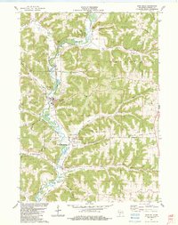
1983 Map of Gays Mills
USGS Topo · Published 1983About this map
The Kickapoo River carves a serpentine path through this Driftless Area landscape, anchoring the valley settlements of Gays Mills, Bell Center, and Petersburg. By the early 1980s, the local transportation network reflected a mix of modernization and memory, where an Old Railroad Grade runs parallel to the river, tracing the path of former rail commerce. The terrain is defined by a dense system of ridges and coulees, including Vinegar Ridge and Larsen Ridge, which forced roads like Johnstown Road and Deathpoint Road to follow narrow crests or valley floors.
Find a feature on this map
50 named features on this map. Tap any name to fly to it.
Don’t see what you’re looking for? This feature index may not catch every label — zoom into the map to look around manually.
Map Details
Editions of this 1983 Gays Mills Map
This is the sole edition of this map. No revisions or reprints were ever made.
Other maps of this area

1924 · Gays Mills
USGS Topo · 1:62,500

1926 · Gays Mills
USGS Topo · 1:62,500

1926 · Wauzeka
USGS Topo · 1:62,500

1933 · Boaz
USGS Topo · 1:62,500

1933 · Boscobel
USGS Topo · 1:62,500

1958 · La Crosse
USGS Topo · 1:250,000

1961 · La Crosse
USGS Topo · 1:250,000

1965 · La Crosse
USGS Topo · 1:250,000
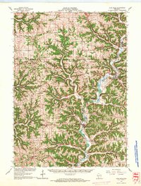
1966 · Gays Mills
USGS Topo · 1:62,500

1966 · Boaz
USGS Topo · 1:62,500