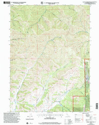
2001 Map of Gazelle Mountain
USGS Topo · Published 2004About this map
Klamath National Forest dominates this mountain landscape in Siskiyou County, where the topography is defined by the high elevations of Gazelle Mtn and the distinct volcanic form of Scott Crater. The map reveals a high-country economy focused on seasonal grazing and small-scale resource extraction, indicated by several scattered corral sites and mining prospect locations. Transportation through this complex terrain follows the natural drainages of Noyes Valley and the East Fork Scott River.
Find a feature on this map
29 named features on this map. Tap any name to fly to it.
Don’t see what you’re looking for? This feature index may not catch every label — zoom into the map to look around manually.
Map Details
Editions of this 2001 Gazelle Mountain Map
This is the sole edition of this map. No revisions or reprints were ever made.
Other maps of this area

1886 · Shasta
USGS Topo · 1:250,000

1894 · Shasta
USGS Topo · 1:250,000

1923 · Sawyers Bar
USGS Topo · 1:125,000

1931 · Etna
USGS Topo · 1:96,000

1932 · Yreka
USGS Topo · 1:96,000

1934 · Etna
USGS Topo · 1:125,000

1939 · Yreka
USGS Topo · 1:125,000

1948 · Weed
USGS Topo · 1:250,000

1950 · Weed
USGS Topo · 1:250,000

1954 · Yreka
USGS Topo · 1:62,500