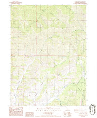
1986 Map of Gazelle Mtn
USGS Topo · Published 1986About this map
Gazelle Mtn and the high watershed of the Scott River define this Siskiyou County landscape during the mid-1980s. The map illustrates a complex drainage network characterized by deep incisions like McConaughy Gulch, Meadow Gulch, and Sissel Gulch that feed into primary arteries such as Moffet Creek. Human presence is marked by a network of 4wd tracks and several extraction points identified simply as Prospect, suggesting a history of mineral exploration in the shadow of the Klamath National Forest.
Find a feature on this map
25 named features on this map. Tap any name to fly to it.
Don’t see what you’re looking for? This feature index may not catch every label — zoom into the map to look around manually.
Map Details
Editions of this 1986 Gazelle Mtn Map
This is the sole edition of this map. No revisions or reprints were ever made.
Other maps of this area

1886 · Shasta
USGS Topo · 1:250,000

1894 · Shasta
USGS Topo · 1:250,000

1923 · Sawyers Bar
USGS Topo · 1:125,000

1931 · Etna
USGS Topo · 1:96,000

1932 · Yreka
USGS Topo · 1:96,000

1934 · Etna
USGS Topo · 1:125,000

1939 · Yreka
USGS Topo · 1:125,000

1948 · Weed
USGS Topo · 1:250,000

1950 · Weed
USGS Topo · 1:250,000

1954 · Yreka
USGS Topo · 1:62,500