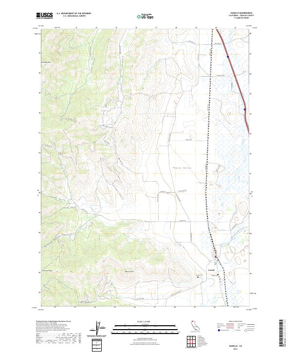
2021 Map of Gazelle
USGS Topo · Published 2021About this map
Gazelle sits at the edge of the Shasta Valley in this modern topographic study, where the flat valley floor meets the complex drainage systems of the surrounding highlands. The map documents a landscape defined by its network of gulches, including Long Gulch, Guys Gulch, and Lime Gulch, which channel water toward the lower elevations. Local history is anchored by the presence of Gazelle Cem and Foulke Cem, while the modern transportation corridor is represented by Old Hwy 99 S and the nearby Railroad Ln. Higher elevations are marked by distinctive landmarks such as Antelope Mtn, Bonnet Rock, and Scarface Ridge, illustrating the transition from ranching lands to more vertical terrain. The drainage of Willow Cr dominates the eastern portion of the quadrangle, weaving through a grid of local roads like Scarface Rd and Timmons Rd that provide access to the area's agricultural and rural residential sections.
Find a feature on this map
43 named features on this map. Tap any name to fly to it.
Don’t see what you’re looking for? This feature index may not catch every label — zoom into the map to look around manually.
Map Details
Editions of this 2021 Gazelle Map
This is the sole edition of this map. No revisions or reprints were ever made.
Other maps of this area

1886 · Shasta
USGS Topo · 1:250,000

1894 · Shasta
USGS Topo · 1:250,000

1921 · Shasta Valley Sheet No 7
USGS Topo · 1:24,000

1921 · Shasta Valley Sheet No 1
USGS Topo · 1:24,000

1921 · Shasta Valley Sheet No 6
USGS Topo · 1:24,000

1921 · Shasta Valley Sheet No 2
USGS Topo · 1:24,000

1922 · Shasta Valley Sheet No 1 S
USGS Topo · 1:24,000

1922 · Shasta Valley Sheet No 3 S
USGS Topo · 1:24,000
1922 · Shasta Valley Sheet No 8
USGS Topo · 1:24,000

1923 · Sawyers Bar
USGS Topo · 1:125,000