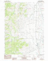
1984 Map of Gazelle
USGS Topo · Published 1984About this map
The Shasta Valley landscape transitions from the volcanic high ground of Antelope Mtn down to the agricultural flats surrounding the settlement of Gazelle. This 1980s era survey captures the heavy influence of water management on the region, featuring an intricate network of ditches and drainage channels alongside natural water bodies like Big Lake and Willow Creek. Transport and infrastructure are defined by the Southern Pacific rail line and several prominent ranch roads including Old Highway 99 and Callahan Road.
Find a feature on this map
29 named features on this map. Tap any name to fly to it.
Don’t see what you’re looking for? This feature index may not catch every label — zoom into the map to look around manually.
Map Details
Editions of this 1984 Gazelle Map
This is the sole edition of this map. No revisions or reprints were ever made.
Other maps of this area

1886 · Shasta
USGS Topo · 1:250,000

1894 · Shasta
USGS Topo · 1:250,000

1921 · Shasta Valley Sheet No 7
USGS Topo · 1:24,000

1921 · Shasta Valley Sheet No 1
USGS Topo · 1:24,000

1921 · Shasta Valley Sheet No 6
USGS Topo · 1:24,000

1921 · Shasta Valley Sheet No 2
USGS Topo · 1:24,000

1922 · Shasta Valley Sheet No 1 S
USGS Topo · 1:24,000

1922 · Shasta Valley Sheet No 3 S
USGS Topo · 1:24,000
1922 · Shasta Valley Sheet No 8
USGS Topo · 1:24,000

1923 · Sawyers Bar
USGS Topo · 1:125,000