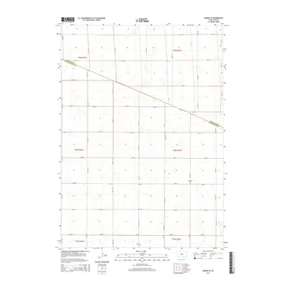
2015 Map of Geddes SE
USGS Topo · Published 2015About this map
Scattered prairie wetlands and a precise section-line road grid define this rural landscape on the border of Douglas and Charles Mix counties. The terrain is marked by numerous small depressions and basins, characteristic of the glaciated plains of South Dakota. Human activity is centered around agriculture and traditional burial grounds, with Saint Paul Cem situated in the eastern portion of the quadrangle and Cohee Cem located to the south.
Find a feature on this map
27 named features on this map. Tap any name to fly to it.
Don’t see what you’re looking for? This feature index may not catch every label — zoom into the map to look around manually.
Map Details
Editions of this 2015 Geddes SE Map
This is the sole edition of this map. No revisions or reprints were ever made.
Other maps of this area

1955 · Mitchell
USGS Topo · 1:250,000

1959 · Mitchell
USGS Topo · 1:250,000

1964 · Ravinia
USGS Topo · 1:24,000

1964 · Lake Andes NW
USGS Topo · 1:24,000

1964 · Lake Andes
USGS Topo · 1:24,000

1977 · Lake Andes NW
USGS Topo · 1:24,000
1977 · Lake Andes
USGS Topo · 1:24,000

1979 · Geddes SE
USGS Topo · 1:24,000
1979 · Geddes
USGS Topo · 1:24,000

1979 · New Holland
USGS Topo · 1:24,000