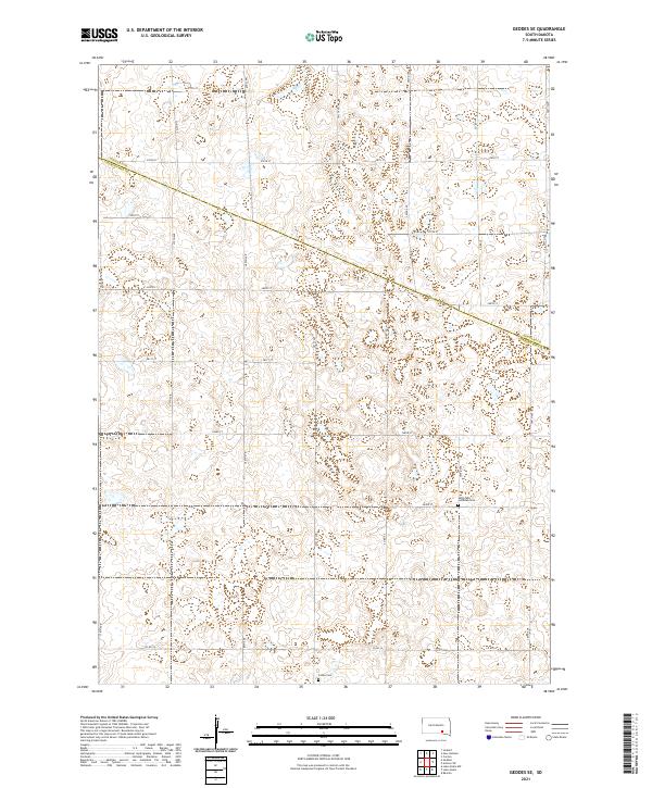
2021 Map of Geddes SE
USGS Topo · Published 2021About this map
The Douglas Co Charles Mix Co line bisects this landscape, marking a rural boundary in the heart of South Dakota's prairie. This 2021 survey reveals a territory structured by an exacting section-line road grid, including 380th Ave and 278th St, which define the agricultural movement of the region. Local history is anchored at the Saint Paul Lutheran Cem near the center-east of the sheet and the Cohee Cem to the south. These small, scattered burial grounds serve as the primary markers of early settlement and community continuity in a landscape otherwise dominated by expansive fields and natural drainage patterns. The map details a network of secondary routes like Co Hwy 23 and Co Rd 19 that connect these remote homesteads and townships, including t98n r65w and t99n r66w, across the rolling plains.
Find a feature on this map
27 named features on this map. Tap any name to fly to it.
Don’t see what you’re looking for? This feature index may not catch every label — zoom into the map to look around manually.
Map Details
Editions of this 2021 Geddes SE Map
This is the sole edition of this map. No revisions or reprints were ever made.
Other maps of this area

1955 · Mitchell
USGS Topo · 1:250,000

1959 · Mitchell
USGS Topo · 1:250,000

1964 · Ravinia
USGS Topo · 1:24,000

1964 · Lake Andes NW
USGS Topo · 1:24,000

1964 · Lake Andes
USGS Topo · 1:24,000

1977 · Lake Andes NW
USGS Topo · 1:24,000
1977 · Lake Andes
USGS Topo · 1:24,000

1979 · Geddes SE
USGS Topo · 1:24,000
1979 · Geddes
USGS Topo · 1:24,000

1979 · New Holland
USGS Topo · 1:24,000