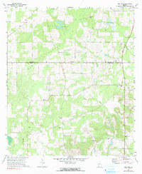
1971 Map of Gee Pond
USGS Topo · Published 1991About this map
Big Slough and Kelly Creek define the low-lying drainage patterns across this 1971 survey of the Georgia borderlands. The landscape is characterized by its sinkholes and depressions, most notably the water-filled Gee Pond, Bay Pole Sink, and the aptly named Glory Hole. This agricultural region is dotted with numerous small rural congregations that served as community hubs, including Clayton Ch, Allen Chapel, and Beauty Grove Ch.
Find a feature on this map
21 named features on this map. Tap any name to fly to it.
Don’t see what you’re looking for? This feature index may not catch every label — zoom into the map to look around manually.
Map Details
Editions of this 1971 Gee Pond Map
2 editions found
Other maps of this area

1953 · Dothan
USGS Topo · 1:250,000

1954 · Dothan
USGS Topo · 1:250,000

1954 · Tallahassee
USGS Topo · 1:250,000

1955 · Dothan
USGS Topo · 1:250,000

1955 · Whigham
USGS Topo · 1:62,500

1956 · Cairo
USGS Topo · 1:62,500

1959 · Tallahassee
USGS Topo · 1:250,000

1960 · Tallahassee
USGS Topo · 1:250,000

1971 · Gee Pond
USGS Topo · 1:24,000

1971 · Vada
USGS Topo · 1:24,000