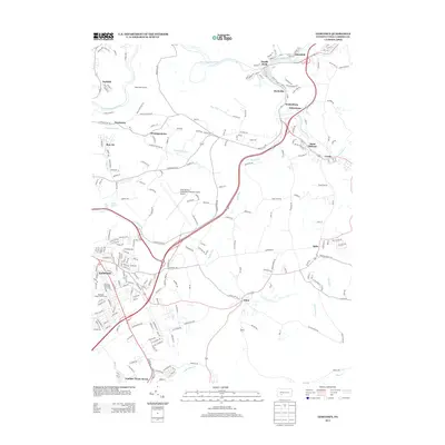
2013 Map of Geistown
USGS Topo · Published 2013About this map
The Little Conemaugh River carves a deep valley through this portion of Cambria County, defining the landscape of industrial-era settlements and natural features. Significant engineering history is present at the Staple Bend Tunnel, while the modern infrastructure of the John Murtha Johnstown-Cambria County Airport occupies the central plateau. To the south, the borough of Geistown exhibits a dense suburban street grid, contrasting with the more dispersed mining and railroad towns like South Fork and Ehrenfeld along the riverbanks. The map documents the persistent identity of small communities such as Saint Michael and Salix, along with the curiously named Number Thirty-Seven. Natural landmarks, including White Tail Falls and Winding Staircase Falls, punctuate the numerous runs and creeks that feed into the Conemaugh watershed, illustrating the varied geography of the Allegheny Front.
Find a feature on this map
249 named features on this map. Tap any name to fly to it.
Don’t see what you’re looking for? This feature index may not catch every label — zoom into the map to look around manually.
Map Details
Editions of this 2013 Geistown Map
This is the sole edition of this map. No revisions or reprints were ever made.
Other maps of this area

1902 · Ebensburg
USGS Topo · 1:62,500

1904 · Ebensburg
USGS Topo · 1:62,500

1904 · Johnstown
USGS Topo · 1:62,500

1907 · Johnstown
USGS Topo · 1:62,500

1908 · Bedford
USGS Topo · 1:62,500

1910 · Bedford
USGS Topo · 1:62,500

1914 · Windber
USGS Topo · 1:62,500

1916 · Windber
USGS Topo · 1:62,500

1944 · Windber
USGS Topo · 1:62,500

1953 · Pittsburgh
USGS Topo · 1:250,000