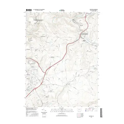
2016 Map of Geistown
USGS Topo · Published 2016About this map
Johnstown Flood National Memorial and the Allegheny Portage Railroad National Historic Site anchor this landscape, preserving the industrial and environmental history of Cambria County. The terrain is defined by the steep valleys of the Little Conemaugh River and its many tributaries, including Sandy Run and Solomon Run. A dense network of small settlements such as South Fork, Saint Michael, and Geistown reflects the area's deep-rooted coal and rail heritage, with the Norfolk Southern line following the river's winding course. Higher ground is occupied by modern institutions like the University of Pittsburgh-Johnstown and the John Murtha Johnstown-Cambria County Airport. Genealogists will find numerous burial sites noted, from the South Fork Cem to the smaller Snavely Cem, providing a detailed record of the local population centers and family origins.
Find a feature on this map
179 named features on this map. Tap any name to fly to it.
Don’t see what you’re looking for? This feature index may not catch every label — zoom into the map to look around manually.
Map Details
Editions of this 2016 Geistown Map
This is the sole edition of this map. No revisions or reprints were ever made.
Other maps of this area

1902 · Ebensburg
USGS Topo · 1:62,500

1904 · Ebensburg
USGS Topo · 1:62,500

1904 · Johnstown
USGS Topo · 1:62,500

1907 · Johnstown
USGS Topo · 1:62,500

1908 · Bedford
USGS Topo · 1:62,500

1910 · Bedford
USGS Topo · 1:62,500

1914 · Windber
USGS Topo · 1:62,500

1916 · Windber
USGS Topo · 1:62,500

1944 · Windber
USGS Topo · 1:62,500

1953 · Pittsburgh
USGS Topo · 1:250,000