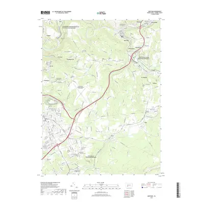
2019 Map of Geistown
USGS Topo · Published 2019About this map
The Allegheny Portage Railroad National Historic Site and the Johnstown Flood National Memorial anchor this portion of Cambria County, marking two of the region's most significant industrial and disaster milestones. The landscape is defined by the steep valleys carved by the Little Conemaugh River and the South Fork Little Conemaugh River, where small coal-era settlements like Ehrenfeld, South Fork, and St. Michael grew alongside the water and rail lines. Near the Staple Bend Tunnel, the terrain reveals the engineering challenges of the early railroad era.
Find a feature on this map
188 named features on this map. Tap any name to fly to it.
Don’t see what you’re looking for? This feature index may not catch every label — zoom into the map to look around manually.
Map Details
Editions of this 2019 Geistown Map
This is the sole edition of this map. No revisions or reprints were ever made.
Other maps of this area

1902 · Ebensburg
USGS Topo · 1:62,500

1904 · Ebensburg
USGS Topo · 1:62,500

1904 · Johnstown
USGS Topo · 1:62,500

1907 · Johnstown
USGS Topo · 1:62,500

1908 · Bedford
USGS Topo · 1:62,500

1910 · Bedford
USGS Topo · 1:62,500

1914 · Windber
USGS Topo · 1:62,500

1916 · Windber
USGS Topo · 1:62,500

1944 · Windber
USGS Topo · 1:62,500

1953 · Pittsburgh
USGS Topo · 1:250,000