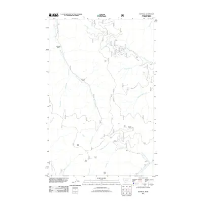
2011 Map of Gem Peak
USGS Topo · Published 2011About this map
Holliday Mine and the high vantage point of Gem Peak Lookout anchor this 2011 survey of the Idaho-Montana borderlands. The landscape is defined by a dense network of watercourses and sharp vertical relief, including Gem Peak, Ulm Peak, and Eighty Peak. These summits divide the drainage basins of East Fork Elk Creek to the west and the various branches of Marten Creek and Pilgrim Creek to the east. Remote access is facilitated by forest roads such as Pilgrim Creek Rd and RD 44, which wind through terrain marked by named landmarks like Lost Cabin Gulch and Lone Cliff. The presence of the mine and lookout suggest a history of resource extraction and fire management within the Shoshone County wilderness, where Idaho Point and Bottle Point overlook the deep valleys of Ulm Creek and Gem Creek.
Find a feature on this map
30 named features on this map. Tap any name to fly to it.
Don’t see what you’re looking for? This feature index may not catch every label — zoom into the map to look around manually.
Map Details
Editions of this 2011 Gem Peak Map
This is the sole edition of this map. No revisions or reprints were ever made.
Other maps of this area

1909 · Cataldo
USGS Topo · 1:125,000

1911 · Cataldo
USGS Topo · 1:125,000

1911 · Priest Lake
USGS Topo · 1:250,000

1913 · Priest Lake
USGS Topo · 1:250,000

1920 · Libby
USGS Topo · 1:125,000

1930 · Libby
USGS Topo · 1:125,000

1932 · Libby
USGS Topo · 1:125,000

1932 · Trout Creek
USGS Topo · 1:125,000

1935 · Trout Creek
USGS Topo · 1:125,000

1936 · Trout Creek
USGS Topo · 1:125,000