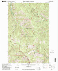
1997 Map of Gem Peak
USGS Topo · Published 2000About this map
The Bitterroot Range forms a formidable natural boundary on this late-twentieth-century survey, where the Idaho Montana state line traces the high ridges of the Coeur D'Alene National Forest. This high-altitude landscape is defined by its massive peaks and the drainage systems of the Kaniksu National Forest. Historical industry is represented by the Holiday Mine tucked into a northern drainage near West Fork Pilgrim Creek. The map provides a detailed look at the wilderness geography before more modern developments, showing the convergence of Sanders Co Shoshone Co boundaries. Prominent summits like Gem Peak and Ulm Peak serve as primary landmarks for navigating the steep terrain between Lone Cliff Gulch and the various branches of Smeads Creek.
Find a feature on this map
31 named features on this map. Tap any name to fly to it.
Don’t see what you’re looking for? This feature index may not catch every label — zoom into the map to look around manually.
Map Details
Editions of this 1997 Gem Peak Map
This is the sole edition of this map. No revisions or reprints were ever made.
Other maps of this area

1909 · Cataldo
USGS Topo · 1:125,000

1911 · Cataldo
USGS Topo · 1:125,000

1911 · Priest Lake
USGS Topo · 1:250,000

1913 · Priest Lake
USGS Topo · 1:250,000

1920 · Libby
USGS Topo · 1:125,000

1930 · Libby
USGS Topo · 1:125,000

1932 · Libby
USGS Topo · 1:125,000

1932 · Trout Creek
USGS Topo · 1:125,000

1935 · Trout Creek
USGS Topo · 1:125,000

1936 · Trout Creek
USGS Topo · 1:125,000