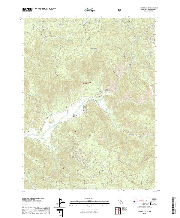
2022 Map of Genesee Valley
USGS Topo · Published 2022About this map
The settlement of Genesee and the lush Genesee Valley form the heart of this contemporary landscape, where Indian Creek and Red Clover Cr meet. This survey provides a modern look at the public lands within the Plumas National Forest, highlighting the complex topography of the Northern Sierra region. Local history is anchored by the Davis Family Cem, a small burial ground situated just north of the creek, which speaks to the early ranching and homesteading families who first populated these mountain meadows. The surrounding terrain is defined by prominent elevations such as Wheeler Peak and Kessler Peak, alongside ridges like Peel Ridge and Turner Ridge. Narrow roads like Antelope Rd and the Beckworth Genesee Rd trace the drainage patterns of Hosseikus Cr and Last Chance Cr, maintaining the same essential routes that have connected these high-altitude valleys for generations.
Find a feature on this map
38 named features on this map. Tap any name to fly to it.
Don’t see what you’re looking for? This feature index may not catch every label — zoom into the map to look around manually.
Map Details
Editions of this 2022 Genesee Valley Map
This is the sole edition of this map. No revisions or reprints were ever made.
Other maps of this area

1886 · Honey Lake
USGS Topo · 1:250,000

1891 · Downieville
USGS Topo · 1:125,000

1891 · Honey Lake
USGS Topo · 1:250,000

1893 · Honey Lake
USGS Topo · 1:250,000

1893 · Downieville
USGS Topo · 1:125,000

1895 · Downieville
USGS Topo · 1:125,000

1896 · Downieville
USGS Topo · 1:125,000

1897 · Downieville
USGS Topo · 1:125,000

1937 · Blairsden
USGS Topo · 1:48,000

1943 · Blairsden
USGS Topo · 1:62,500