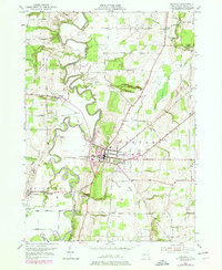
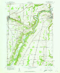
1950 Map of Geneseo
USGS Topo · Published 1978About this map
Geneseo serves as the focal point of this mid-century survey, shown just as the State University of New York at Geneseo was expanding its footprint. The village is surrounded by a complex landscape of deep river meanders and historic transport routes, including the Genesee and Wyoming RR and the Erie RR. To the west, the winding Genesee River carves through the valley, passing near the small settlements of Piffard and Cuylerville. Evidence of the region's industrial past is seen in the Salt Mines (Inactive) near the western edge of the quadrangle.
Find a feature on this map
59 named features on this map. Tap any name to fly to it.
Don’t see what you’re looking for? This feature index may not catch every label — zoom into the map to look around manually.
Map Details
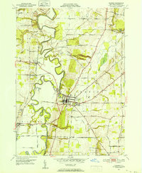
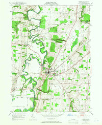
Editions of this 1950 Geneseo Map
4 editions found

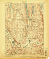
Other maps of this area

1901 · Honeoye
USGS Topo · 1:62,500

1902 · Wayland
USGS Topo · 1:62,500
1904 · Wayland
USGS Topo · 1:62,500

1904 · Caledonia
USGS Topo · 1:62,500
1904 · Honeoye
USGS Topo · 1:62,500

1905 · Nunda
USGS Topo · 1:62,500
1934 · Rush
USGS Topo · 1:24,000

1942 · Conesus
USGS Topo · 1:31,680

1942 · Livonia
USGS Topo · 1:31,680
1943 · Mount Morris
USGS Topo · 1:24,000