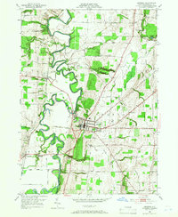
1950 Map of Geneseo
USGS Topo · Published 1966About this map
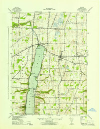
The meandering Genesee River carves a dramatic path through this mid-century landscape, flanked by the competing rail lines of the Erie RR and the Pennsylvania RR. At the heart of the region, the village of Geneseo is defined by its educational and civic institutions, most notably the State Teachers College and the local Armory. The industrial history of the valley is evident near Cuylerville, where a Salt Mine (Inactive) points to the subterranean resources that once fueled local commerce.
Find a feature on this map
48 named features on this map. Tap any name to fly to it.
Don’t see what you’re looking for? This feature index may not catch every label — zoom into the map to look around manually.
Map Details
Editions of this 1950 Geneseo Map
4 editions found
Other maps of this area

1901 · Honeoye
USGS Topo · 1:62,500

1902 · Wayland
USGS Topo · 1:62,500

1904 · Wayland
USGS Topo · 1:62,500

1904 · Caledonia
USGS Topo · 1:62,500

1904 · Honeoye
USGS Topo · 1:62,500

1905 · Nunda
USGS Topo · 1:62,500

1934 · Rush
USGS Topo · 1:24,000

1942 · Conesus
USGS Topo · 1:31,680
1942 · Livonia
USGS Topo · 1:31,680

1943 · Mount Morris
USGS Topo · 1:24,000