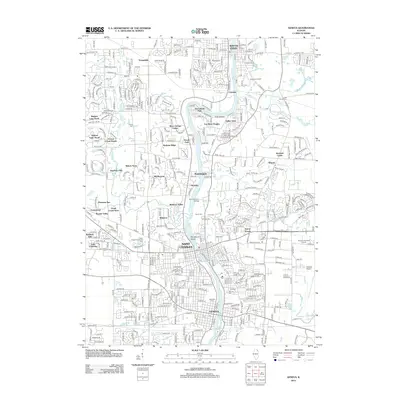
2012 Map of Geneva
USGS Topo · Published 2012About this map
Saint Charles and Geneva anchor this Fox River corridor, where suburban expansion meets long-standing riverfront architecture. The map reveals a densely organized landscape of residential developments like Wildrose Valley and Fox River Heights, interspersed with older landmarks including Dunham Castle and the sprawling grounds of Saint Dominic College. Significant genealogical value is found in the numerous burial sites across the quadrangle, from Oak Hill Cem and Westside Cem near the downtown centers to the more isolated Little Woods Cem further north. The Fox River remains the central geographic feature, dotted with islands such as Boy Scout Island and the Five Islands park area. To the east, the modern industrial and transportation footprint is evidenced by Dupage Airport and the Woodland Landfill.
Find a feature on this map
52 named features on this map. Tap any name to fly to it.
Don’t see what you’re looking for? This feature index may not catch every label — zoom into the map to look around manually.
Map Details
Editions of this 2012 Geneva Map
This is the sole edition of this map. No revisions or reprints were ever made.
Other maps of this area

1908 · Wheaton
USGS Topo · 1:62,500

1923 · Barrington
USGS Topo · 1:62,500

1925 · Elgin
USGS Topo · 1:62,500

1932 · Geneva
USGS Topo · 1:62,500

1935 · Barrington
USGS Topo · 1:62,500

1940 · Elgin
USGS Topo · 1:62,500

1948 · Wheaton
USGS Topo · 1:62,500

1948 · Geneva
USGS Topo · 1:62,500

1949 · Geneva
USGS Topo · 1:24,000

1950 · Aurora North
USGS Topo · 1:24,000