
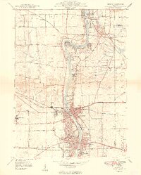
1949 Map of Geneva
USGS Topo · Published 1949About this map
The Fox River corridor serves as the primary artery of development in this 1940s survey, anchoring the industrial and institutional character of the Fox Valley. Large-scale social and religious institutions dominate the landscape, from the St Joseph Seminary and Sacred Heart Seminary to the expansive grounds of the State Boys School and the State Girls School. These institutional anchors, along with landmarks like Dunham Castle, reflect a transitional era where traditional town centers like St Charles and Geneva began to interface with specialized state and private campuses.
Find a feature on this map
41 named features on this map. Tap any name to fly to it.
Don’t see what you’re looking for? This feature index may not catch every label — zoom into the map to look around manually.
Map Details
Editions of this 1949 Geneva Map
2 editions found
Other maps of this area

1908 · Wheaton
USGS Topo · 1:62,500

1923 · Barrington
USGS Topo · 1:62,500

1925 · Elgin
USGS Topo · 1:62,500

1932 · Geneva
USGS Topo · 1:62,500

1935 · Barrington
USGS Topo · 1:62,500

1940 · Elgin
USGS Topo · 1:62,500

1948 · Wheaton
USGS Topo · 1:62,500

1948 · Geneva
USGS Topo · 1:62,500

1950 · Aurora North
USGS Topo · 1:24,000

1953 · Naperville
USGS Topo · 1:24,000