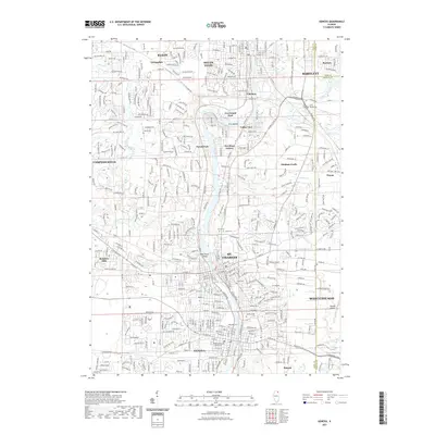
2021 Map of Geneva
USGS Topo · Published 2021About this map
The Fox River corridor serves as the central spine of this modern topographic survey, connecting a string of established river towns including St. Charles, Geneva, and South Elgin. This landscape reflects the dense suburbanization of the outer Chicago metro area, where residential developments like Novak Park and Valley View sit alongside older institutional landmarks such as the Kane County Courthouse. The eastern edge of the map transitions into the transportation hubs of Bartlett and West Chicago, anchored by the Dupage Airport.
Find a feature on this map
45 named features on this map. Tap any name to fly to it.
Don’t see what you’re looking for? This feature index may not catch every label — zoom into the map to look around manually.
Map Details
Editions of this 2021 Geneva Map
This is the sole edition of this map. No revisions or reprints were ever made.
Other maps of this area

1908 · Wheaton
USGS Topo · 1:62,500

1923 · Barrington
USGS Topo · 1:62,500

1925 · Elgin
USGS Topo · 1:62,500

1932 · Geneva
USGS Topo · 1:62,500

1935 · Barrington
USGS Topo · 1:62,500

1940 · Elgin
USGS Topo · 1:62,500

1948 · Wheaton
USGS Topo · 1:62,500

1948 · Geneva
USGS Topo · 1:62,500

1949 · Geneva
USGS Topo · 1:24,000

1950 · Aurora North
USGS Topo · 1:24,000