
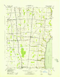
1943 Map of Geneva North
USGS Topo · Published 1943About this map
Pre-Emption Road and Central York Road define the transport corridors of this rural landscape during the early 1940s, a period when the agricultural heart of the region was still served by a dense network of local district schools and family cemeteries. The terrain north of Geneva is dotted with numerous small water bodies like Junius Ponds and Bullhead Pond, while the Canandaigua Outlet meanders through the western portion of the quadrangle. The influence of the New York Central RR and Lehigh Valley RR is evident near Packwood Corners and Oaks Corners, reflecting the rail-driven economy that supported small settlements like West Junius and Dublin. Genealogists may find value in the specific locations of the Quaker Cem and Newton Cem, along with numerous numbered schoolhouses such as School No 16 and School No 9 that once anchored these crossroads communities.
Find a feature on this map
62 named features on this map. Tap any name to fly to it.
Don’t see what you’re looking for? This feature index may not catch every label — zoom into the map to look around manually.
Map Details
Editions of this 1943 Geneva North Map
This is the sole edition of this map. No revisions or reprints were ever made.
Other maps of this area

1899 · Palmyra
USGS Topo · 1:62,500

1902 · Geneva
USGS Topo · 1:62,500

1902 · Clyde
USGS Topo · 1:62,500

1902 · Phelps
USGS Topo · 1:62,500

1902 · Palmyra
USGS Topo · 1:62,500

1942 · Stanley
USGS Topo · 1:31,680

1943 · Lyons
USGS Topo · 1:31,680

1943 · Geneva South
USGS Topo · 1:31,680

1943 · Phelps
USGS Topo · 1:31,680
1943 · Romulus
USGS Topo · 1:31,680