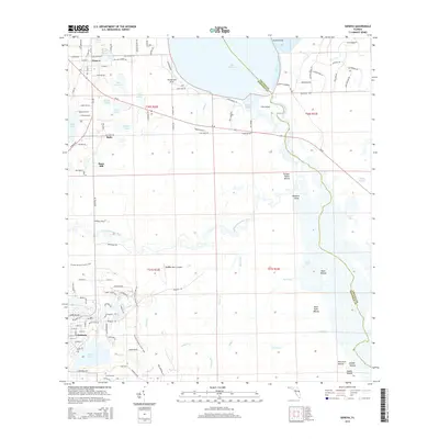
2015 Map of Geneva
USGS Topo · Published 2015About this map
Geneva and Chuluota anchor this portrait of the central Florida lake country, where the winding Saint Johns River and Econlockhatchee River define the local geography. The landscape is dotted with numerous bodies of water, from the expansive Lake Harney and Puzzle Lake to smaller basins like Lake Proctor and Mill Lake. This edition highlights the region's diverse land use, ranging from the rural air facility at Big-Oaks Ranch Airport to the preserved pathways of the Florida National Scenic Trail. An intriguing archaeological dimension is present in the numerous named earthworks along the river basins, including Moccasin Mound, Saddle Mound, and Buck Point Mound. These features, alongside the Chuluota Cem and small settlements like Buda and Snow Hill, provide a rich spatial context for those tracing the development and natural history of Seminole County.
Find a feature on this map
117 named features on this map. Tap any name to fly to it.
Don’t see what you’re looking for? This feature index may not catch every label — zoom into the map to look around manually.
Map Details
Editions of this 2015 Geneva Map
This is the sole edition of this map. No revisions or reprints were ever made.
Other maps of this area

1949 · Osceola
USGS Topo · 1:24,000

1950 · Maytown
USGS Topo · 1:24,000

1950 · Aurantia
USGS Topo · 1:24,000

1953 · Geneva
USGS Topo · 1:24,000

1953 · Titusville SW
USGS Topo · 1:24,000

1953 · Oviedo SW
USGS Topo · 1:24,000

1953 · Bithlo
USGS Topo · 1:24,000

1955 · Orlando
USGS Topo · 1:250,000

1956 · Oviedo
USGS Topo · 1:24,000

1957 · Orlando
USGS Topo · 1:250,000