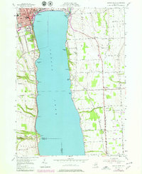
1953 Map of Geneva South
USGS Topo · Published 1979About this map
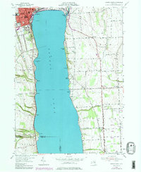
Seneca Lake dominates this mid-century topographic perspective, revealing the deep-water basin and its developed shoreline at the southern edge of Geneva. The city's academic and social infrastructure is well-defined by the Colleges of the Seneca and the Geneva Country Club, while a Lighthouse stands as a navigational sentinel on the water. Along the eastern shore, the transition from recreation at Pastime Park and Seneca Lake State Park to the strictly defined Seneca Army Depot military reservation illustrates the strategic and public utility of the landscape during the Cold War era.
Find a feature on this map
63 named features on this map. Tap any name to fly to it.
Don’t see what you’re looking for? This feature index may not catch every label — zoom into the map to look around manually.
Map Details
Editions of this 1953 Geneva South Map
5 editions found
Other maps of this area

1902 · Geneva
USGS Topo · 1:62,500

1902 · Phelps
USGS Topo · 1:62,500

1902 · Ovid
USGS Topo · 1:62,500

1903 · Penn Yan
USGS Topo · 1:62,500

1942 · Penn Yan
USGS Topo · 1:31,680

1942 · Ovid
USGS Topo · 1:31,680

1942 · Stanley
USGS Topo · 1:31,680

1943 · Dresden
USGS Topo · 1:31,680

1943 · Geneva North
USGS Topo · 1:31,680

1943 · Geneva South
USGS Topo · 1:31,680