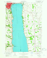
1953 Map of Geneva South
USGS Topo · Published 1966About this map
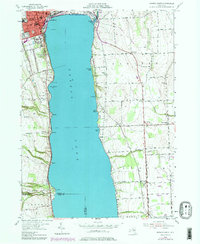
The western shores of Seneca Lake are anchored by the city of Geneva, where the Colleges of the Seneca and the historic Armory overlook the water. This mid-century survey illustrates a landscape of established educational institutions and growing residential districts near the lakefront. To the east, the sprawling US Military Reservation (Seneca Ordnance Depot) occupies a significant portion of the terrain, reflecting the area's strategic importance during and after World War II.
Find a feature on this map
61 named features on this map. Tap any name to fly to it.
Don’t see what you’re looking for? This feature index may not catch every label — zoom into the map to look around manually.
Map Details
Editions of this 1953 Geneva South Map
5 editions found
Other maps of this area

1902 · Geneva
USGS Topo · 1:62,500

1902 · Phelps
USGS Topo · 1:62,500

1902 · Ovid
USGS Topo · 1:62,500

1903 · Penn Yan
USGS Topo · 1:62,500

1942 · Penn Yan
USGS Topo · 1:31,680

1942 · Ovid
USGS Topo · 1:31,680

1942 · Stanley
USGS Topo · 1:31,680

1943 · Dresden
USGS Topo · 1:31,680

1943 · Geneva North
USGS Topo · 1:31,680

1943 · Geneva South
USGS Topo · 1:31,680