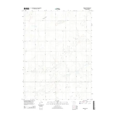
2014 Map of Geneva SW
USGS Topo · Published 2014About this map
Grafton Cem and Holy Cross Cem are situated on the northern edge of this agricultural landscape in Fillmore County, serving as vital landmarks for genealogists and local historians. This region is defined by a rigorous section-line road grid, including Road G through Road N, which facilitates movement across the gently undulating terrain of south-central Nebraska. The drainage patterns of Turkey Cr and the N Fork Turkey Cr break the geometric precision of the fields as they meander eastward. These waterways, along with Elk Run and Indian Cr, dictate the subtle topography of the prairie. In the southern portion of the map, Ne-41 provides a primary east-west corridor, connecting the rural homesteads and farmsteads that rely on this network of gravel and dirt roads.
Find a feature on this map
22 named features on this map. Tap any name to fly to it.
Don’t see what you’re looking for? This feature index may not catch every label — zoom into the map to look around manually.
Map Details
Editions of this 2014 Geneva SW Map
This is the sole edition of this map. No revisions or reprints were ever made.
Other maps of this area

1898 · York
USGS Topo · 1:125,000

1898 · Hebron
USGS Topo · 1:125,000

1899 · York
USGS Topo · 1:125,000

1955 · Lincoln
USGS Topo · 1:250,000

1957 · Lincoln
USGS Topo · 1:250,000

1958 · Lincoln
USGS Topo · 1:250,000

1969 · Bixby
USGS Topo · 1:24,000
1969 · Ong
USGS Topo · 1:24,000
1969 · Geneva
USGS Topo · 1:24,000

1969 · Fairmont
USGS Topo · 1:24,000