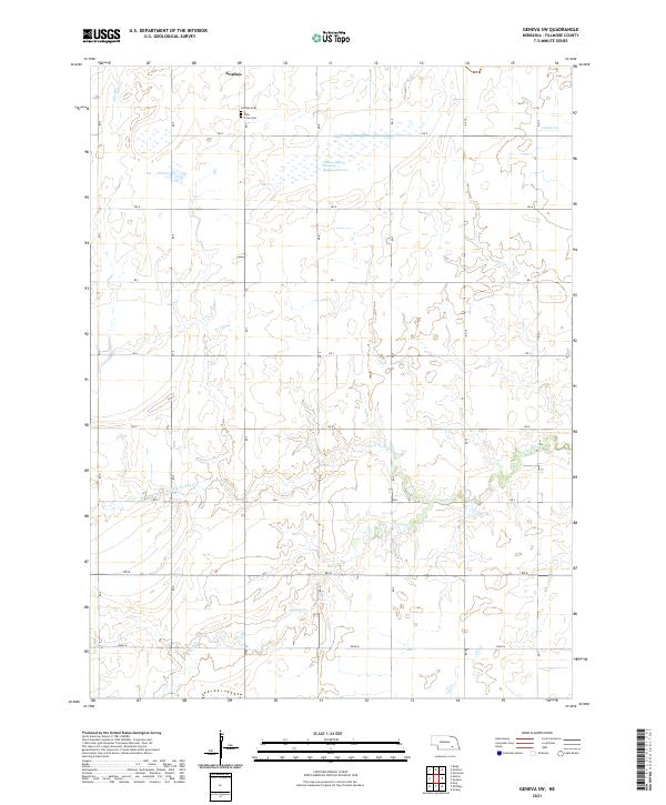
2021 Map of Geneva SW
USGS Topo · Published 2021About this map
The northern edge of Grafton anchors this rural Fillmore County landscape, where the prairie topography is defined by the headwaters of several drainages. Genealogy researchers will find significant interest in the Grafton Cem and the adjacent Holy Cross Cem, situated just south of the town's original footprint. The map reveals a land divided by a precise grid of rural roads, including RD G and RD H, which facilitate travel through the agricultural sections. In the northern reaches, the Wilkins Lagoon National Management Area provides a specialized protected habitat amidst the cultivated fields. The southern half of the quadrangle is marked by the winding courses of the N Fork Turkey Cr and Turkey Cr, where the terrain begins to show more subtle contour variations compared to the flat northern uplands. This 2021 update preserves the exact spatial relationship between legacy burial sites and the natural waterways like Elk Run and Indian Cr.
Find a feature on this map
23 named features on this map. Tap any name to fly to it.
Don’t see what you’re looking for? This feature index may not catch every label — zoom into the map to look around manually.
Map Details
Editions of this 2021 Geneva SW Map
This is the sole edition of this map. No revisions or reprints were ever made.
Other maps of this area

1898 · York
USGS Topo · 1:125,000

1898 · Hebron
USGS Topo · 1:125,000

1899 · York
USGS Topo · 1:125,000

1955 · Lincoln
USGS Topo · 1:250,000

1957 · Lincoln
USGS Topo · 1:250,000

1958 · Lincoln
USGS Topo · 1:250,000

1969 · Bixby
USGS Topo · 1:24,000
1969 · Ong
USGS Topo · 1:24,000
1969 · Geneva
USGS Topo · 1:24,000

1969 · Fairmont
USGS Topo · 1:24,000