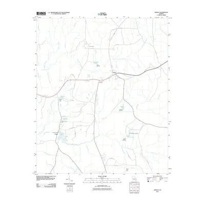
2011 Map of Geneva
USGS Topo · Published 2011About this map
Geneva serves as a central junction in Talbot County, where several local roads and a railway line converge amidst a landscape defined by an intricate network of waterways. This 2011 survey illustrates a region shaped by small-scale hydraulic engineering, evidenced by numerous named reservoirs such as Benson Lake, Hellens Lake, and Meadows Lake, each featuring its own identified dam structure. The drainage patterns of South Fork Upatoi Creek and Juniper Creek dictate the local topography, creating a series of wooded corridors between agricultural tracts and small settlements.
Find a feature on this map
49 named features on this map. Tap any name to fly to it.
Don’t see what you’re looking for? This feature index may not catch every label — zoom into the map to look around manually.
Map Details
Editions of this 2011 Geneva Map
This is the sole edition of this map. No revisions or reprints were ever made.
Other maps of this area

1907 · Talbotton
USGS Topo · 1:125,000

1949 · Upatoi
USGS Topo · 1:24,000

1949 · Buena Vista NW
USGS Topo · 1:24,000

1950 · Talbotton
USGS Topo · 1:24,000

1950 · Geneva
USGS Topo · 1:24,000

1950 · Waverly Hall
USGS Topo · 1:24,000

1950 · Buena Vista NE
USGS Topo · 1:24,000

1950 · Buena Vista
USGS Topo · 1:62,500

1950 · Talbotton
USGS Topo · 1:62,500

1955 · Talbotton
USGS Topo · 1:24,000