
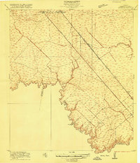
1916 Map of Genoa
USGS Topo · Published 1916About this map
Genoa and Webster anchor this 1916 coastal prairie landscape southeast of Houston, where the development of Southeast Texas transport corridors is clearly visible. The survey highlights the significant role of the Galveston Houston Electric line and the Galveston Houston and Henderson Road, which cut diagonally across the terrain to connect the port of Galveston with the city. These transit routes parallel the natural drainage systems of the region, including Turkey Creek and Horsepen Bayou.
Find a feature on this map
15 named features on this map. Tap any name to fly to it.
Don’t see what you’re looking for? This feature index may not catch every label — zoom into the map to look around manually.
Map Details
Editions of this 1916 Genoa Map
2 editions found
Other maps of this area

1915 · Park Place
USGS Topo · 1:24,000

1915 · Deepwater
USGS Topo · 1:24,000

1916 · Seabrook
USGS Topo · 1:24,000

1916 · La Porte
USGS Topo · 1:24,000

1919 · Deepwater
USGS Topo · 1:31,680

1920 · Seabrook
USGS Topo · 1:31,680

1920 · Genoa
USGS Topo · 1:31,680

1920 · Mykawa
USGS Topo · 1:31,680

1920 · La Porte
USGS Topo · 1:31,680

1922 · Park Place
USGS Topo · 1:31,680