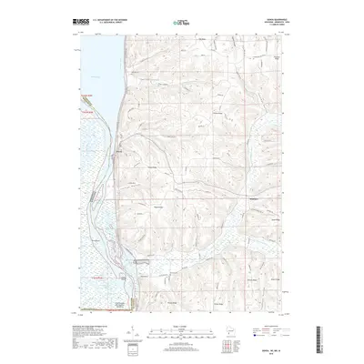
2018 Map of Genoa
USGS Topo · Published 2018About this map
The Mississippi River forms the western boundary of this Vernon County landscape, where the village of Genoa sits along the Great River Rd. To the east, the terrain rises sharply into a series of deeply incised coulees and ridges typical of the region's unglaciated topography. Notable landforms like Genoa Ridge, Victory Ridge, and Asbury Ridge divide the drainage basins of Spring Coulee and the North Fork Bad Axe River.
Find a feature on this map
86 named features on this map. Tap any name to fly to it.
Don’t see what you’re looking for? This feature index may not catch every label — zoom into the map to look around manually.
Map Details
Editions of this 2018 Genoa Map
This is the sole edition of this map. No revisions or reprints were ever made.
Other maps of this area

1903 · Waukon
USGS Topo · 1:125,000

1926 · Stoddard
USGS Topo · 1:62,500

1929 · Ferryville
USGS Topo · 1:62,500

1932 · Ferryville
USGS Topo · 1:62,500

1956 · Brownsville
USGS Topo · 1:62,500

1958 · La Crosse
USGS Topo · 1:250,000

1961 · La Crosse
USGS Topo · 1:250,000

1965 · La Crosse
USGS Topo · 1:250,000
1965 · Stoddard
USGS Topo · 1:62,500

1966 · Ferryville
USGS Topo · 1:62,500