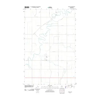
2010 Map of Gentilly
USGS Topo · Published 2010About this map
The Red Lake River meanders across this Polk County landscape, carving deep, serpentine bends that define the local geography. At the heart of the region lies the small settlement of Gentilly, situated near the confluence where the Gentilly River and Kripple Creek meet. This area reflects a long-standing agricultural and riverine tradition, with the landscape divided by a precise grid of county roads such as County Hwy-11 and County Hwy-17.
Find a feature on this map
21 named features on this map. Tap any name to fly to it.
Don’t see what you’re looking for? This feature index may not catch every label — zoom into the map to look around manually.
Map Details
Editions of this 2010 Gentilly Map
This is the sole edition of this map. No revisions or reprints were ever made.
Other maps of this area

1918 · Red Lake Falls
USGS Topo · 1:62,500

1919 · Beltrami
USGS Topo · 1:62,500

1952 · Red Lake Falls
USGS Topo · 1:62,500

1952 · Grand Forks
USGS Topo · 1:250,000

1953 · Crookston
USGS Topo · 1:62,500

1956 · Grand Forks
USGS Topo · 1:250,000

1964 · Greenview
USGS Topo · 1:24,000

1965 · Dugdale
USGS Topo · 1:24,000

1965 · Harold
USGS Topo · 1:24,000

1966 · Grand Forks
USGS Topo · 1:250,000