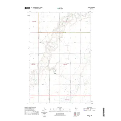
2019 Map of Gentilly
USGS Topo · Published 2019About this map
The meandering Red Lake River dominates this portion of Polk County, carving a complex path through the agricultural landscape of northern Minnesota. This river system, joined by the Gentilly River and Kripple Cr, defines the local topography and historical settlement patterns. Near the river's winding banks, the small communities of Gentilly and Huot serve as local anchors. The map records several sites of significant genealogical interest, including Saint Peters Cem near the town of Gentilly and Huot Cem further north. The precision of the land use is visible in the network of county roads and the strictly engineered County Ditch Number One Hundred Fiftyeight, illustrating the long-standing efforts to manage the Red River Valley’s drainage for farming. This 2019 survey provides a clear view of the rural infrastructure, from the township lines like t150n r45w to the specific sections that define local property history.
Find a feature on this map
39 named features on this map. Tap any name to fly to it.
Don’t see what you’re looking for? This feature index may not catch every label — zoom into the map to look around manually.
Map Details
Editions of this 2019 Gentilly Map
This is the sole edition of this map. No revisions or reprints were ever made.
Other maps of this area

1918 · Red Lake Falls
USGS Topo · 1:62,500

1919 · Beltrami
USGS Topo · 1:62,500

1952 · Red Lake Falls
USGS Topo · 1:62,500

1952 · Grand Forks
USGS Topo · 1:250,000

1953 · Crookston
USGS Topo · 1:62,500

1956 · Grand Forks
USGS Topo · 1:250,000

1964 · Greenview
USGS Topo · 1:24,000

1965 · Dugdale
USGS Topo · 1:24,000

1965 · Harold
USGS Topo · 1:24,000

1966 · Grand Forks
USGS Topo · 1:250,000