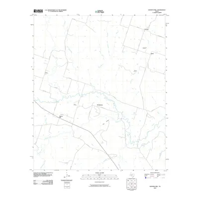
2010 Map of Gentrys Mill
USGS Topo · Published 2010About this map
Leon River meanders across the central landscape of this rural Hamilton County region, shaping a network of tributaries that define the local topography. Small communities such as Sunshine, Springtown, and Spurlin anchor the northern and central sections, connected by a web of county roads including Sunshine Rd and Co Rd 105. The area is notably rich in family history and genealogical markers, as evidenced by the distribution of numerous burial grounds like Tillinghouse Cemetery, Toliver Cemetery, and Barnett Cemetery. The southern reaches are characterized by the meeting of several watercourses, including Warren Creek, Little Bear Creek, and South Mesquite Creek. The namesake Gentrys Mill sits as a primary landmark, reflecting the agricultural and water-reliant history of this Central Texas landscape where small-scale settlements and seasonal creek branches like Owl Hollow intersect.
Find a feature on this map
40 named features on this map. Tap any name to fly to it.
Don’t see what you’re looking for? This feature index may not catch every label — zoom into the map to look around manually.
Map Details
Editions of this 2010 Gentrys Mill Map
This is the sole edition of this map. No revisions or reprints were ever made.
Other maps of this area

1888 · Hamilton
USGS Topo · 1:125,000

1894 · Hamilton
USGS Topo · 1:125,000

1954 · Brownwood
USGS Topo · 1:250,000

1956 · Gustine
USGS Topo · 1:62,500

1956 · Gentrys Mill
USGS Topo · 1:24,000

1956 · Pottsville
USGS Topo · 1:62,500

1956 · Hico
USGS Topo · 1:62,500

1956 · Hamilton
USGS Topo · 1:62,500

1956 · Hamilton West
USGS Topo · 1:24,000
1956 · Eidson Lake
USGS Topo · 1:24,000