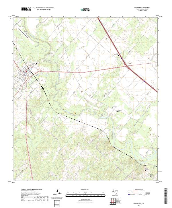
2022 Map of George West
USGS Topo · Published 2022About this map
George West serves as the focal point of this South Texas landscape, where the Live Oak County Courthouse stands as a central landmark for the region. The area is defined by the winding course of the Nueces River, which creates a complex network of drainage features including Timon Cr, Spring Cr, and McKinzey Cr. This modern survey illustrates how local infrastructure, such as the Live Oak County Airport, integrates with the traditional ranching and rural landscape of the Brush Country.
Find a feature on this map
73 named features on this map. Tap any name to fly to it.
Don’t see what you’re looking for? This feature index may not catch every label — zoom into the map to look around manually.
Map Details
Editions of this 2022 George West Map
This is the sole edition of this map. No revisions or reprints were ever made.
Other maps of this area

1920 · Mikeska
USGS Topo · 1:125,000

1925 · Oakville No. 4
USGS Topo · 1:48,000

1925 · Mathis No. 2
USGS Topo · 1:48,000

1927 · Mathis
USGS Topo · 1:62,500

1927 · Oakville
USGS Topo · 1:62,500

1953 · Crystal City
USGS Topo · 1:250,000

1953 · Beeville
USGS Topo · 1:250,000

1954 · Fleming
USGS Topo · 1:62,500

1954 · Mathis
USGS Topo · 1:62,500

1955 · Crystal City
USGS Topo · 1:250,000